Enchanting places in Trentino Alto Adige: tourist areas not to be missed
Val di Genova
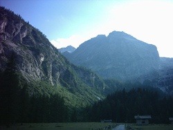 Inserted between the Adamello groups to the south, and from Presanella to the north, Val di Genova is known as the valley of waterfalls for the many jumps of water that are found on its territory. Near the Val Rendena, in the western area of the Adamello Brenta Natural Park, it is possible to cross it, starting from Carisolo, for more than 17 km, when the road ends arriving at Pian di Bédole, where the glacier of the Adamello-Madron which, thanks to its 18 km 2 , is the largest in the Italian Alps. The characteristic crystalline rock formations, the tonalites, which can be admired both from the valley floor and from the expanses of ice, were the stage of many military operations during the First World War.
Beyond the Nàrdis waterfall , which originates from the Presanella glacier, there are numerous jumps of water. Among the Casòl, Làres and Folgorìda waterfalls , obtained from the descent of the Sarca river, it is possible to meet Casina Muta, Pedrùc, Pont delle Cambiali, Stablèi and Madron, and many others.
There is a vast vegetation characterized by beech, larch, birch, fir and mountain pine trees, it is possible to admire many specimens of alpine fauna an example are marmots, roe deer, ibex, squirrels, the brown bear recently re-entered into the Park and the eagle real. In the winter months, the frozen waterfalls attract many mountaineers who are passionate about ice climbing.
Vallesinella
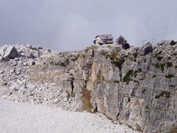 The wonders of Vallesinella between natural bridges, springs, caves and paths completely inserted in the wonderful nature surrounding it.
It can be accessed starting from Madonna di Campiglio , Vallesinella can be visited along a dirt path by car for 5 km and consists of numerous water jumps and caves carved into the dolomite, a typical rock of the Dolomites.
The journey of the Bear that originates from the Spinale cable car and crosses the Spinale mountain in a transversal way is a valid option for those who want to travel the valley on foot. Crossed by a branch of the Sarca river, Vallesinella is covered by woods of white fir and beech for over 2,000 m. to then become a typical high mountain landscape where it is possible to see the glacial structure that gave life to the valley itself.
The Vallesinella river characterized by three waterfalls called high, middle and below, continues along the valley giving a wonderful landscape, characterized by the presence of numerous caves and many karst phenomena as a consequence of the flow of water, which over time has given rise to natural bridges and springs.
The caves of considerable depth, between 523 and 386 meters, can be reached at high altitudes, near the walls of the Torrione di Vallesinella and Castelletto di Mezzo. Vallesinella is the entrance to one of the best-known mountaineering routes because it gives the possibility to reach the Quintino Sella and FF Tuckett refuges, which began in 1904 and 1906. From here the routes with two ascents originate, that of Cima Brenta and del Castelletto Inferiore and the Sosat path, a part of the Bocchette route.
Val di Fumo
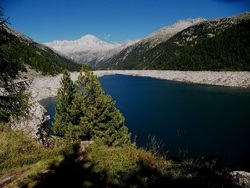 Walks and paths by the lake or at high altitudes, to rediscover the Val di Fumo at the Adamello Brenta Natural Park.
Within the Adamello Brenta Natural Park, the Val di Fumo is one of the most enchanting and wildest alpine valleys of glacial derivation. It is possible to access the valley starting from Praso continuing along the road to Val Daone up to the artificial lake of Malga Bissina, characterized by a large car park.
The Val di Fumo is the ideal place to undertake numerous excursions, an example is that of Lake Campo, Lake Malga Bissina, on the South-West side of Carè Alto but also towards adjacent mountain ranges.
The fauna of the Val di Fumo is among the most typical of the Adamello Brenta Park: chamois, roe deer, marmots, hares, the golden eagle and - in the waters of lakes and streams - trout and char
Val di Breguzzo
The Val Breguzzo goes from 800 to 3,000 m, it was known in the past for the presence of iron pyrite and silver galena mines, the upper area of the Val Breguzzo which has entered the territory of the Adamello-Brenta Natural Park thanks to the recent extension. The valley, when it continues in the protected area, takes two different names: Val Trivena and Piano del Redont, a place where it is possible to admire spectacular waterfalls.
It is possible to reach the Val Breguzzo continuing towards the state road 239 starting from Tione and turning right between the cities of di Breguzzo and Bondo. With 800 meters of the village of Breguzzo and 3,000 of the highest peaks, it is possible to admire all the species and vegetation present in these areas: starting from the coppice to the fir forest up to the alpine prairie.
From a faunal point of view, the valley is home to chamois, squirrels and marmots and is dominated by the golden eagle.
Schedule:
It is advisable to contact the Consortium for information on organized visits in Val Breguzzo.
Val Canali
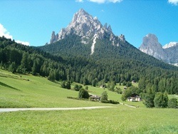 Val Canali is one of the most beautiful alpine valleys, dominated by the remains of Castel Pietra, a stage for sieges and wars.
Val Canali is considered one of the most beautiful alpine valleys, it is the southern gateway to the Pale di San Martino group. Particularly interesting and evocative is the road that leads to the mouth of the valley which continues under the remains of the ancient Castel Pietra. A wonderful landscape made up of pastures of Piereni, located at over 1,200 m on the slope of the western area of the valley. Trade and economic sustenance are still based on agriculture and pastoralism.
The Canali peak, with the arrival of the evening, changes into a jagged grayish wall characterized by red-rust streaks. The ruin of Castel Pietra overlooks the whole valley. Built in the thirteenth century, it is a fortress that was the stage of numerous wars, sieges and revolts. Thanks to a suggestive atmosphere, the Val Canali has become over the years a place of attraction very frequented by travelers.
Forest of violins
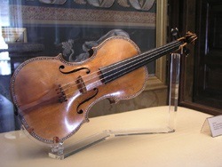 The remote secret of the master luthiers lies in the spruce of Val Venegia.
The wood of the spruce trees of the Val di Fiemme hides the remote secret of the production of perfect violins: many master luthiers, including the Stradivari, arrived in these areas from Cremona to buy the noblest woods to make them become musical instruments of magnificent perfection .
It is said that it was Stradivari himself who wandered around the Paneveggio forest to find the most suitable trees for the construction of his violins, specifically the firs typical of the place, the centuries-old red ones.
Characteristically elastic is the wood of the spruce and precisely because of this characteristic it gives off the sound better and its lymphatic channels are very similar to organ pipes that generate resonance.
It is possible to reach the forest of violins starting from the Paneveggio Visitor Center, located a few kilometers from the Forte Buso Lake, at the state road N.50 which climbs from Predazzo to Passo Rolle.
Val d'Ambiez
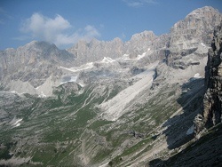 Among the main access routes towards the Brenta group starting from the South-East side, the Val d'Ambiez, a marked river route that, to the tourist, looks like a path wedged between very narrow rocky walls.
Following the gorge, the valley appears stealthily distracting the gaze towards the pastures of the Malga Prato, continuing up to the Cacciatore Refuge (1,821 m) where it is possible to admire, in all its importance, the wonderful circle of the Dolomite peaks.
Also in the upper valley, it is possible to visit the Agostini Refuge located at 2,410 m of altitude, an area both of departure and of arrival towards the crossings and ascents in the Brenta Group: the Cima Tosa, the Cima Prato Fiorito, the Cima d ' Ambiez, the Tosa and Pedrotti refuges along the Brentari equipped road or the XII Apostoli Refuge along the Castiglioni via ferrata, the Brentei Refuge along the Bocca d'Ambiez and the Vedretta dei Camosci.
Val di Peio
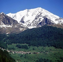 Internationally renowned health resort and spa, it is located at the foot of the majestic Ortles-Cevedale group.
Val di Peio, a small valley located in the Trentino sector of the Stelvio National Park, is dotted with forests of fir trees, larch trees and patches of green pastures, dominated by the mighty spectacle of glaciers, from which clear streams flow into the valley creating waterfalls. .
The horizon is occupied by the massive snow-covered mass of the Vioz, on which the refuge and the church stand out, until a few years ago the highest in Europe. Then there are the larch trees of Comàsine, the cradle of the Solandra mining activity, and a little further on, solitary, the church of S. Lucia.
Already inhabited by Gallic peoples, the Val di Peio is a land of ancient colonization, due to the resources of the subsoil, but also to the fact of being the passage corridor towards Lombardy to the west, from the Montozzo pass towards the Valtellina, Bormio and towards the Switzerland, further north, from the Sforzellina pass to the Gavia pass, passage of smugglers.
Mocheni Valley
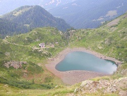 A wonderful valley that presents unique natural beauties, an area that presents a remote history and tradition, inhabited by communities of German origin, the Mòcheni.
The Valle dei Mòcheni is a particular area of Trentino where German is spoken. Also referred to as an enchanted valley thanks to the beautiful natural scenery, an enchanted place at any time of the year, where it is possible to undertake itineraries between meadows and woods circumscribed by peaks close to 2,400 meters in the western area of the Lagorai chain. From the top of Palù del Fersina it is possible to enjoy a wonderful panorama located at the underlying Valsugana. Among the most enchanting areas it is legitimate to mention Lake Erdemolo, at 2,000 meters, which can be reached in about 2 hours on foot.
About 20 km from Trento, there is the Valle dei Mòcheni also known for the culture and traditions of its inhabitants, a German minority that arrived in this area in the Middle Ages, particularly attracted by the presence of gold, pyrite and quartz mines. There are many legends and tales that have formed from these historical episodes.
Worthy of note is the Museum of the Mòcheni / Bernstol Valley and the exhausted mine of Palù / Palai, places where it is still possible to admire the marks left by the knappen (miners) who once worked there. There are also many huts and farms, an example is that of Fierozzo, Maso Filzerhof, a house of Mochena origin dating back to 1400. Also not to be missed is the ancient water mill of Frassulongo / Garait.